A beach is a landform along the shoreline of an ocean, sea, lake, or river. It usually consists of loose particles, which are often composed of rock, such as sand, gravel, shingle, pebbles, or cobblestones. The particles comprising the beach are occasionally biological in origin, such as mollusc shells or coralline algae.

There are several conspicuous parts to a beach that relate to the processes that form and shape it. The part mostly above water (depending upon tide), and more or less actively influenced by the waves at some point in the tide, is termed the beach berm. The berm is the deposit of material comprising the active shoreline. The berm has a crest (top) and a face — the latter being the slope leading down towards the water from the crest. At the very bottom of the face, there may be a trough, and further seaward one or more long shore bars: slightly raised, underwater embankments formed where the waves first start to break
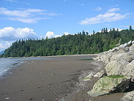
The shoreline throughout these beaches is mainly rocky with some sandy stretches with fewer beach-goers. An area is provided for owners to have their dogs off leash. During the smelt season, naturists share this area with declothed fishers and their families. Smelt fishing is typically prohibited from the middle of June to the middle of August.
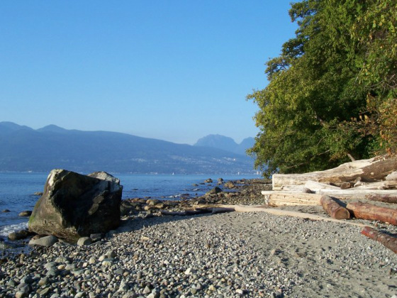
Acadia Beach is short walk down a gentle slope from the parking lot on Marine Drive where there is a grassy area with several picnic tables. Tower Beach is at the end of the much longer Trail 3 and Point Grey is near the steeper Trail 4. There is pay parking close to Trail 3 and 4 at the Museum of Anthropology. All of Wreck Beach is contiguous and it is possible to walk along the entire coastline. However, when the tide is too high, access can be limited.
Acadia Beach is short walk down a gentle slope from the parking lot on Marine Drive where there is a grassy area with several picnic tables. Tower Beach is at the end of the much longer Trail 3 and Point Grey is near the steeper Trail 4. There is pay parking close to Trail 3 and 4 at the Museum of Anthropology. All of Wreck Beach is contiguous and it is possible to walk along the entire coastline. However, when the tide is too high, access can be limited.
While the entire 7 km beach around to Point Grey from Acadia Beach to Booming
Ground Creek is often referred to as Wreck Beach, the large sandy area on the
north side of the North Arm Breakwater at the base of Trail 6 is what many think
of when they talk about Wreck Beach. The trail is the most
developed of the trails down the bluff and consists of 483 wooden steps. This
section of the beach is the most heavily used. At the bottom you will find a
stretch of sand between two artificial rock jetties as a water breaks lined by a
row of licensed vendors selling imported clothing, jewelry, drinks, snacks, and
other beach related items. Other unlicensed vendors may be found wander the
beach selling alcoholic beverages and other more illicit cash crops of British
Columbia.
Clothing is optional throughout Wreck Beach. Due to Wreck Beach's proximity to the University of British Columbia, many students and even faculty, can be found at Wreck Beach. In recent years many beach users have objected, on both privacy and environmental grounds, to the University's plans to construct new buildings too close to the cliff edge and partially overlooking the beach.
Clothing is optional throughout Wreck Beach. Due to Wreck Beach's proximity to the University of British Columbia, many students and even faculty, can be found at Wreck Beach. In recent years many beach users have objected, on both privacy and environmental grounds, to the University's plans to construct new buildings too close to the cliff edge and partially overlooking the beach.
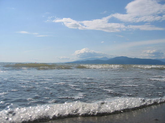
The trail has recently been improved with the addition of handrails and better stairs. The ocean here was stagnant and polluted - however changes in booming practices have helped to revive the balance and water is now considered suitable for swimming.
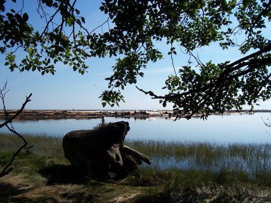
At the bottom of the trail one can choose to go right (northwest) or left (southeast). There are several sandy spits several hundred meters to the northwest. There are numerous small pockets of sand along the trail in both directions. There are also a number of small trails, all along this area. The estuary area to the North is known as the Oasis
At the bottom of the trail one can choose to go right (northwest) or left (southeast). There are several sandy spits several hundred meters to the northwest. There are numerous small pockets of sand along the trail in both directions. There are also a number of small trails, all along this area. The estuary area to the North is known as the Oasis
There is a small parking lot at Acadia Beach, a pay parking lot south of Trail 6 and several pay parking lots on the UBC campus. Free parking is also allowed all along the east side of S.W. Marine Drive (opposite the cliff side) and along Old Marine Drive. Illegally parked vehicles are often towed away.
The GVRD provides limited sanitary facilities. There are outhouses by the Acadia Beach parking lot and at the tops of Trails 6 and 7 and there are also portable toilets at the base of Trail 6. There is no running water, so many visitors bring their own. A few times over the years, the Metro Vancouver health authorities have issued warnings that the beach Coliform counts are too contaminated for swimming- however for the most part, Wreck Beach tends to have a lower count than many Vancouver Beaches.
The GVRD provides limited sanitary facilities. There are outhouses by the Acadia Beach parking lot and at the tops of Trails 6 and 7 and there are also portable toilets at the base of Trail 6. There is no running water, so many visitors bring their own. A few times over the years, the Metro Vancouver health authorities have issued warnings that the beach Coliform counts are too contaminated for swimming- however for the most part, Wreck Beach tends to have a lower count than many Vancouver Beaches.
